
Livingston ZIP Code Coverage
07039 is the verified standard mailing ZIP for Livingston Township. The postal research found two distinct 07039 ZIP+4 points, but they are delivery add-ons for individual postal locations, not separate neighborhood ZIP codes or separate municipalities. The main counter and the South Livingston Station both operate within the 07039 service context. A ZIP code directory should therefore keep the primary ZIP separate from a ZIP+4 address point and from an unconfirmed postal-bulletin reference.
| Postal code | Livingston use | USPS location | Research note |
|---|---|---|---|
| 07039 | Standard Township mailing ZIP | Main Livingston Post Office and South Livingston Station | Primary postal key; not a legal boundary |
| 07039-9998 | Main-post-office delivery point | 49 W Mount Pleasant Ave | ZIP+4, not a neighborhood |
| 07039-9991 | South-station delivery point | 25 W Northfield Rd, Ste C | ZIP+4, not a second municipal ZIP |
| 07068 | Postal Bulletin mapping reference | 2023 Postal Bulletin | Needs direct USPS confirmation before use as a current Livingston ZIP |
The research did not locate an official USPS polygon that draws the whole 07039 boundary. That matters because a ZIP identifies mail-routing geography, not a parcel's municipal jurisdiction. Confirm the township through the assessment record, tax map, deed, or parcel layer.
Two Livingston USPS Service Points
The USPS Livingston Post Office listing identifies the main counter at 49 W Mount Pleasant Ave, Livingston, NJ 07039-9998, with 973-992-8401. The published retail hours are Monday through Friday 8:30 to 5 and Saturday 8:30 to 1. Its PO Box access hours are longer. The separate South Livingston Station listing is at 25 W Northfield Rd, Ste C, Livingston, NJ 07039-9991, with weekday service listed from 9 to 4 and no Saturday service shown.
Use the source record before copying a ZIP+4 into address research. The distinct endings, 9998 and 9991, are station-specific delivery points. They do not turn one Township into two ZIP code areas.
The USPS location record provides the source for this Livingston ZIP code directory image.
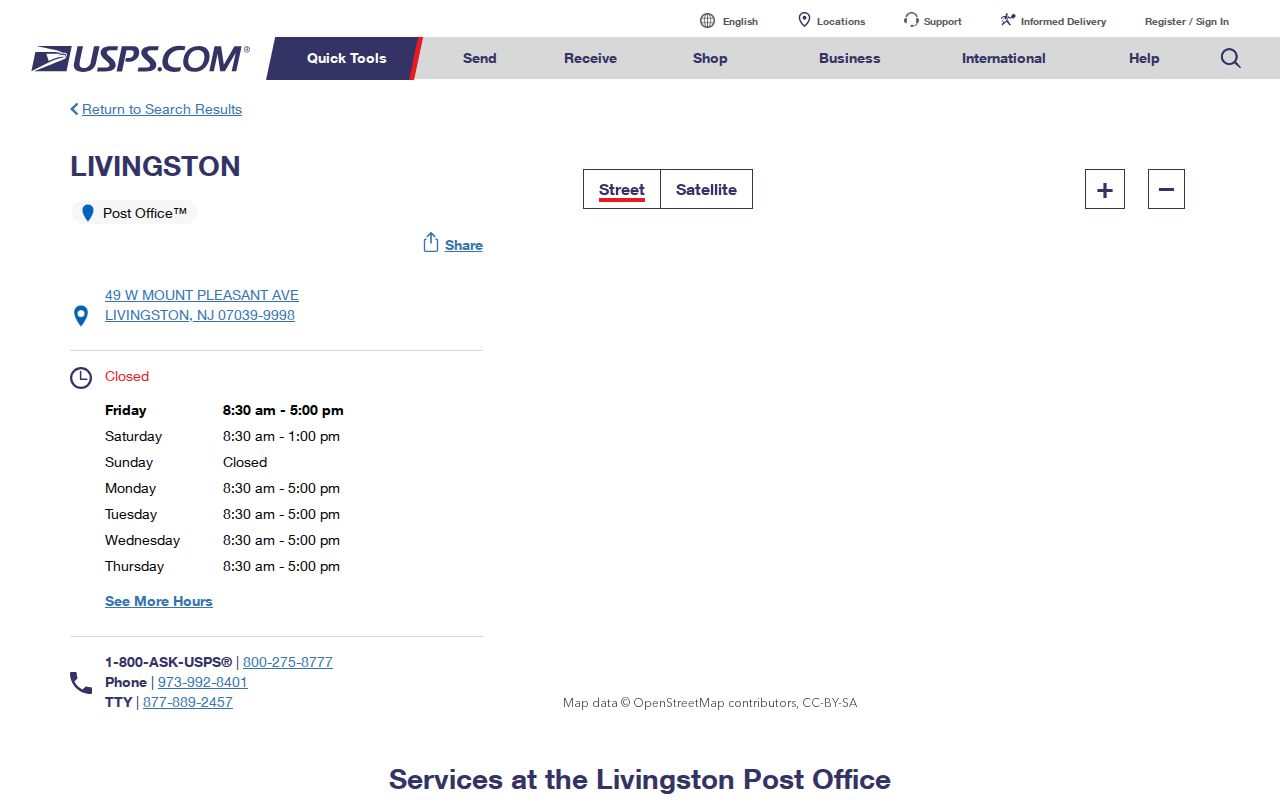
The captured listing supports the address and ZIP+4 normalization step, while the assessment and tax-map sources remain necessary for parcel and municipal confirmation.
Search a Livingston ZIP Code
A Livingston ZIP code is a useful first check, but the documented public systems do not all search it in the same way. USPS can verify postal formatting and a specific postal location. The county assessment route reliably begins with owner, property location, block, lot, and municipality. Its fetched official page did not show a confirmed ZIP filter, so it should not be described as a ZIP-wide resident search. Essex voter lists are requested by district, not ZIP.
- Verify the mailing ZIP and the intended address with the USPS lookup or location result.
- Use the exact street and municipality in the Essex property assessment route, then record block, lot, and qualifier if supplied.
- Open the corresponding tax-map sheet or parcel layer to confirm the parcel geometry and municipal context.
- For election material, request an existing Essex district list and use the normalized address to determine the correct district.
- For an older household, search the street and house number in a dated regional directory because 1950 entries predate ZIP codes.
Once the postal check narrows an address to a street, the Livingston street directory has the fuller address-by-address trail.
Livingston ZIP Verification Fields
Use only verified fields when moving from postal geography to a record system. USPS location results identify a post-office address and its ZIP+4. The official Essex County property assessment route is suitable for a parcel lookup, but the research did not confirm a live ZIP search control. Its location and parcel fields are more dependable for a Livingston address.
| Source or field | Input or result | What it can confirm | Limit |
|---|---|---|---|
| USPS address or location | Address; location result; ZIP+4 | Postal formatting and a specific postal point | Not a township-boundary or parcel system |
| Assessment property location | Street address | Physical property record lead | Does not establish an occupant |
| Assessment municipality | Livingston selection | County-hub jurisdiction narrowing | ZIP filter not confirmed in the live screen |
| Block, lot, qualifier | Parcel identifiers | Stable bridge to tax maps and deeds | Not a postal code |
| Voter district request | Municipality, district, election date | Existing district list route | Districts are not ZIP zones |
“Situs” means the physical property location. It differs from an owner mailing address, which is where tax correspondence goes. A postal address can be valid while the property owner lives elsewhere, and a property owner can differ from the people who lived at the address.
Livingston ZIP Code Limits
Postal city labels and township limits can overlap without matching exactly. Livingston is a township in Essex County, while 07039 is a postal service key. An address carrying Livingston and 07039 should still be checked in the tax assessment, deed, tax map, or parcel record before it is treated as an address within the Township. The 07068 reference in a 2023 Postal Bulletin is particularly unsuitable as a current Livingston assignment until USPS confirms it directly.
- ZIP code
- A USPS routing code used to sort mail. It is not a legal municipal boundary.
- ZIP+4
- The four digits added to a base ZIP to identify a narrower delivery segment or postal point.
- PO Box ZIP
- A postal code or delivery context tied to boxes at a post office, not proof of a home location.
- Unique ZIP
- A code assigned to a single organization or delivery context. No verified Livingston unique ZIP was located.
- Carrier route
- A USPS delivery grouping. It can aid mail operations but does not identify all people on a block.
Livingston ZIP Code History Clues
ZIP searching cannot replace historical geography. The official Livingston timeline names Teedtown or Livingston Center, Northfield, Morehousetown or Livingston Circle, Cheapside or Livingston Mall, Washington Place, and Squiertown or Route 10 Circle. These are historical settlement clues, not extra ZIP codes. A name in an older directory or newspaper may use one of them instead of the modern postal label.
Centerville's 1908 separation to form Roseland can also make an old address seem to fall outside present Livingston. Preserve the old name, street spelling, cross street, house number, and any block or lot, then compare it with a date-appropriate map or deed. That approach is safer than forcing an earlier address into a current ZIP label.
Note: The 1950 Livingston directory uses street and Li 6 telephone information because ZIP codes were introduced nationally later.
Livingston Records After ZIP Checks
After a ZIP code directory search verifies the address format, choose the record by its purpose. The Essex County Property Assessment Search Hub route can lead from property location to an owner name, block, lot, assessment history, and deed book or page fields where supplied. Tax maps use block and lot to locate a parcel. The Essex Register PRESS index can then be searched by Livingston and block or lot for the modern online run beginning October 1, 1996, or by grantor and grantee for an ownership-chain lead.
Historical directory entries need a different path. A 1950 line may show a house number, occupant, occupation, and telephone exchange, but it will not show 07039. Search the old street and number at the library or in the regional directory pages, then pair it with a deed, tax map, newspaper, or census for the time period. Records may point to different people because occupancy and title are not the same relationship.
When a Livingston ZIP Needs Proof
Some questions stop at the postal layer. The research found no official 07039 boundary polygon, no direct official ZCTA map for Livingston, and no current USPS confirmation that 07068 is a Livingston ZIP. The stable fallback is straightforward: keep the USPS result for mailing normalization, use Township assessment and tax maps for municipal and parcel confirmation, and ask the relevant custodian when a public portal does not expose the needed field.
For a municipal record tied to a precise address, Livingston's OPRA route can request an existing record such as a tax-map sheet, assessment card, or construction-permit summary. State the street address, block and lot, record type, and date range. A permit may name an applicant or contractor, so it is evidence of work at a date rather than a claim about who lived there.
For a county land-record follow-up, the online PRESS index is a current lead rather than the complete historical answer. Its online index begins October 1, 1996, and date searching is limited to a 90-day span. Earlier Essex work may require the Hall of Records or the State Archives. The State Archives describes grantor and grantee indexes from 1688 to 1909 and surviving deed books beginning in 1793 after the loss of Deed Book A. A ZIP code cannot repair that archival gap, but it can help preserve the modern mailing form beside the older street, parcel, and deed description.
Document the source and date for every postal result. A local post-office counter, a census geography, and a Township parcel each answer a different question. Keeping those roles separate prevents a clean-looking ZIP match from becoming an unsupported statement about a person, a boundary, or a historic address.